Weather:
- Ha Noi 33oC
- Da Nang 30oC
- Ho Chi Minh 33oC

by Cao Hương
China contacted Việt Nam last week to let us know it was planning to open one of its dams to ease rising water levels. And on August 21 it did indeed send water rushing into what becomes the Red River in Việt Nam.
It didn’t say how much was released, which is bad given the Red River Delta is prone to flash flooding from tropical storms, like the recent Higos, which killed seven people, injured four, destroyed 1,000 houses, and damaged more than 1,600ha of crops.
Bát Xát, the westernmost district in Lào Cai Province, is where the Red River starts. Damage has been moderate, though, as the river cuts through remote mountains with isolated communities.
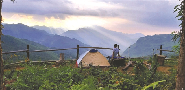
This part of Bát Xát has long been on must-see lists for the northwest, boasting magnificent mountains, clean air, and colourful ethnic minorities. By two or four wheels, distant mountains, misty jungle, and oddly-shaped white clouds count among the jaw-dropping scenery.
Now is harvest time, and tourists and photographers descend upon the mountains to admire and capture the local beauty, try some “new” rice, and breathe in fresh air and rice aroma.
But Bát Xát is beautiful all year round.
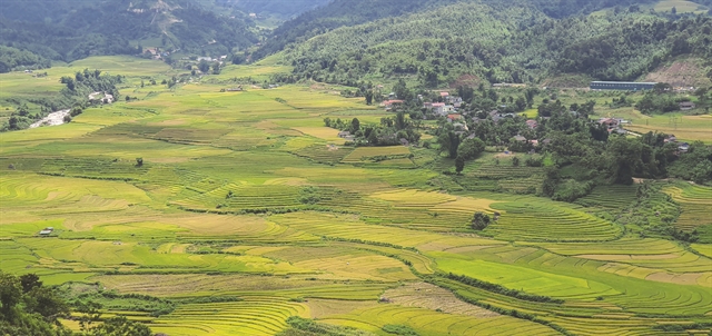
In spring, wild peach and plum flowers in bloom make for a beautiful panorama of mountain slopes blanketed in pink and white. The blanket changes to green in summer, of rice plants in terraced fields.
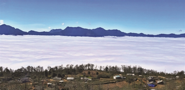
Autumn, which is now, is harvest time, when the ground becomes bare, while winter cold is subdued by heat from wood fires and local maize liquor.
Climb high
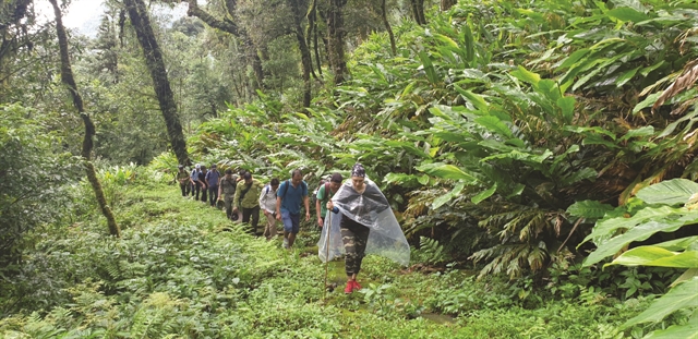
Two mountains around Bát Xát can be found on the list of Việt Nam’s ten highest peaks: Nhìu Cồ San and, higher still, Kỳ Quan San, in the top five.
Nhìu Cồ San means buffalo horns in the Hà Nhì language. In Sàng Ma Sáo Commune and 2,965 metres above sea level, Nhìu Cồ San is largely untouched, with primeval jungle and challenging terrain catching the eye of trekkers and climbers alike.
Kỳ Quan San, meanwhile, runs along the border between Bát Xát and Phong Thổ District, and climbers have put Bạch Mộc Lương Tử height at 3,046m above sea level in the mountain range.
According to amateur climbing clubs, climbers first reached this peak only recently, in 2013. There are two ways up — from Sàng Ma Sáo Commune, which is as far as a vehicle can take you, or from Chí Sáng Commune in neighbouring Lai Châu Province, which is difficult to reach by any means of transport. It’s most definitely only for experienced climbers.
When a cable car made Mt Phan Xi Păng (Fansipan), Việt Nam’s highest peak at 3143m, accessible to nearly everyone in 2016, many climbers began to seek other challenges, especially mountains that had yet to be conquered. And while the Bạch Mộc Lương Tử peak is a particularly challenging place to trek, it’s also among the most rewarding because of its spectacular scenery.
Another new trekking path has opened up in recent years, called the Pavi ancient stone path — a branch of an ancient tea route that connected tea producing regions in Việt Nam, China, Laos, Thailand, Myanmar, and India.
If you’re up to it, try the 200-km trekking loop from Bản Vược to Mường Hum, Dền Sáng, and Y Tý, turn around at Ngải Thầu, then A Lù, A Mú Sung, and Trịnh Tường communes. You won’t be disappointed. Starting from Bản Vược Commune, the route cuts through tea plantations and passes by ethnic Dao women carrying the morning tea harvest on their backs.
You’ll also pass through traditional villages of the ethnic Dao Đỏ and Giáy, where you can admire the wooden architecture of their houses and their traditional folk songs, silversmithing craft in Séo Pờ Hồ hamlet, and famed alcohol distilled from rice buds, called San Lùng.
You’re certain to come across a few charming yet chilly streams and springs along the way, and be ready to pass under waterfalls with names like Red, Dragon and Bee.
You then leave Dền Sáng for Y Tý, where you can explore the life and culture of the Hà Nhì.
Just where the loop starts to close is a newly discovered cave, in A Lù Commune. Reaching the 100-metre-long cave involves passing through a hundred-year-old bamboo forest in Khoa San Chải hamlet, about 1,200m above sea level. Arriving afterwards in A Mú Sung Commune, visitors greet the Lũng Pô flagpole, the point where the Red River begins in Việt Nam’s territory.
Ethnic life and colours
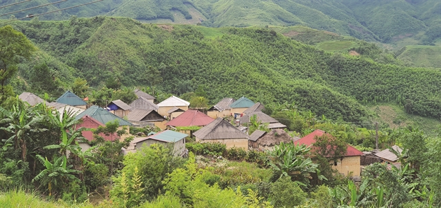
Adding to the beautiful natural landscapes of Bát Xát, the people who call the land home make local life and culture a voyage of discovery. The Hà Nhì, Giáy, Dao, and Mông live next to each other but maintain their own traditions and customs. The Giáy honour their terraced rice field rituals, the Hà Nhì worship their jungles, the Dao preserve their sacred fire dancing myths, and the Mông perform their traditional pan-pipe dance — the pride of any Mông man.
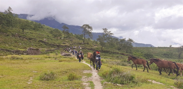
If you venture up anywhere in the mountains, try not to miss a market fair, where local life is on display amid vibrant colours and get-togethers. This is where local farm and forest produce is brought on the back of horses or of people.
Local people also open their doors to visitors, in community tourism programmes where tourists get to live the life of real mountain people.
Authorities at all levels have invested in upgrading the road network and assisted in designing, packaging and marketing local products. Sustainability reigns above all for local governments, businesses and tour operators. — VNS
Recommended treks:
1. Sa Pa - Bản Xèo - Mường Hum - Sàng Ma Sáo - Dền Sáng - Y Tý - A Mú Sung - Lào Cai, and return.
2. Lào Cai - Bát Xát - Mường Vi - Bản Xèo - Mường Hum - Bản Khoang - Tả Giàng Phìng - Sa Pa, and return.
3. Sa Pa - Bản Xèo - Mường Hum - Y Tý - A Lù - A Mú Sung - Trịnh Tường - Lào Cai, and return.
4. Sa Pa - Bản Xèo - Mường Hum - Khu Chu Phìn - Phong Thổ - Lai Châu, and return.
