Weather:
- Ha Noi 35oC
- Da Nang 31oC
- Ho Chi Minh 34oC

Lâm Giang
We had a wonderful and unforgettable experience when trekking the Tà Năng - Phan Dũng route, which is considered the most beautiful trekking route in Việt Nam. And if you have a chance, try it once.
Tà Năng - Phan Dũng route is located across the two provinces of Lâm Đồng - Bình Thuận. Tà Năng Commune belongs to Đức Trọng District, Lâm Đồng Province, while Phan Dũng Commine is located in Tuy Phong District, Bình Thuận Province. The route is perfect for those who love to explore. It is about 35km.
With diversified vegetation, majestic scenery, and moderate difficulty, it is suitable for trekking for people of different ages.
Tà Năng side is a beautiful route, with trees growing on both sides of the road, and the slope is not too high. As for Phan Dũng, the road is quite slippery. In Tà Năng, the evening dew is quite thick and fast, and the wind is especially strong in the middle of the night.
To trek this route safely and see the full beauty of nature here, we equipped ourselves with the necessary skills.
The first was psychological and health preparation. We would be in the forest for two days, and there would be almost no phone signal. The temperature drops very low in the evening, and the wind is always strong. Therefore, we prepared warm clothes, and sleeping bags, to get used to self-sufficient personal hygiene in a forest. Health was a necessary and sufficient condition for us to cross the route on our own feet.
The road was not too difficult, but there were many turns. We contacted the porter and the guide to help us during the journey. They helped our team move more smoothly and avoid getting lost.
We departed from HCM City to a homestay of Tày ethnic people at the edge of Tà Năng Forest to rest and enjoy the peaceful atmosphere of the highlands before trekking.
The next morning, before entering the forest, we had a wonderful breakfast in the warm early morning sun of an omelette with hot bread and greens.
The guide then gave us the safety rules for the journey and detailed information about the distance, climate and terrain. Each person was given a walking stick, a raincoat and a water bottle.
The starting point of trekking was a rice field of the Churu people. The Churu people follow the matrilineal system, meaning the porter we hired had to ask his wife's permission to go with us.
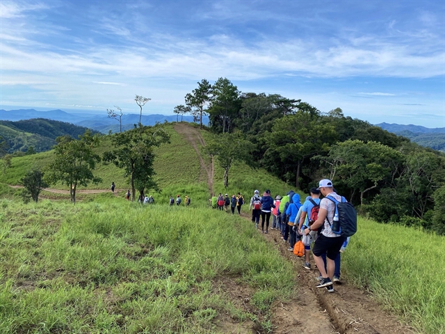
We continued to pass the cool three-leaf pine forests. We began to enjoy listening to the sound of the pines in the wind. After the first 6km of flat road and a few small murmuring streams, we started climbing some slopes.
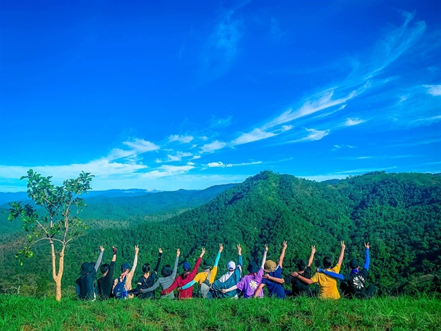
The slopes here were not too high, but they seemed to stretch endlessly, and the whole group kept wondering when the slope would end. However, the reward began to appear when we reached the first grass hill, a majestic natural scenery stretched out.
The green grass hills were like a beautiful steppe. The fresh air of the plateau and the cool breezes alleviated the previous hardships.
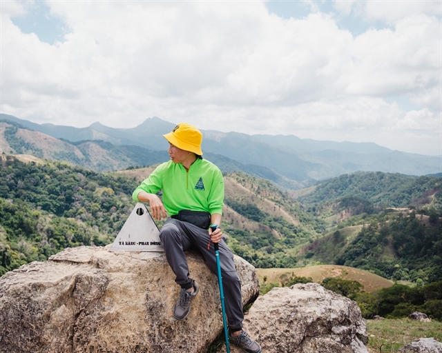
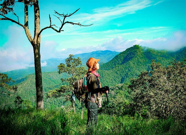
We came to the territory of Phan Dũng Commune, where there is a stainless steel top marking the coordinates of the boundary of the two provinces of Lâm Đồng–Bình Thuận. From here, we could see the highest mountain in the area, named Hòn Diên by the French.
Rumour has it that there was a rampant tiger with three legs on the mountain, so many people did not dare to cross that area. From the border of the two provinces, there will be two directions towards Phan Dũng. We chose to go towards Lính Hill, not Yavly Waterfall, because it was the rainy season.
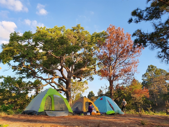
We arrived at the campsite, Hai Cây Thông (Two pine trees) Hill, in the late afternoon. The hill is about 900m above sea level and has a wide view. Most trekking groups camp here.
In the evening, we had dinner and sang in the peaceful atmosphere of the wild mountains and forests, ending the day with a glass of fragrant sticky rice wine. We then went to bed early to wake up early to catch the sunrise on the plateau.
To reach the finish line, we went downhills from an altitude of 900m to 400m. The guide showed us the change in elevation by observing the difference in the landscape from temperate coniferous forest to mixed broadleaf-coniferous forest to grasslands and finally deciduous forest, also known as dipterocarp forest - which is extremely harsh here in the dry season because most of the streams will be dry if lost, it will be difficult to find water.
The forests of Dầu tree began to appear dense with the characteristic of extremely thick bark to resist the harsh sun of northern Bình Thuận.
In the past, the Chăm people used the sap of the Dầu tree to waterproof the boats and make fuel and mortar for the bricks of the Chăm towers.
After going downhill continuously, we took a break for lunch at a small stream. We closed our eyes to listen to the sound of birds chirping and streams flowing.
We continued to walk in the forest until early afternoon. The last part of the forest landscape was no longer beautiful, and the motorbike taxi yard of the Raglai people was in front of us; from here to the finish line, Phan Dũng Commune, was just 5km.
During the trek, we tried to have a calm mind to have a dialogue with nature, to hear the birdsong, the wind, the rustling leaves, the murmuring streams, the whispering grass and even the sound of ourselves looking for answers that the busy space of the city distracted us. VNS